A Winter Storm Watch is Coming to the Northern California Mountains this Week
After a warm and sunny weekend across Northern California, the weather pattern is about to flip.
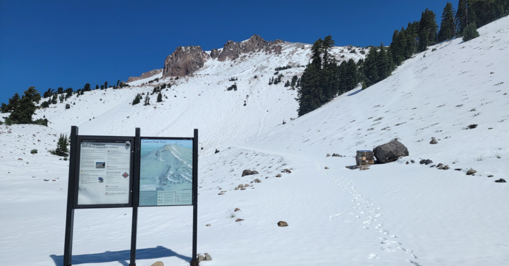
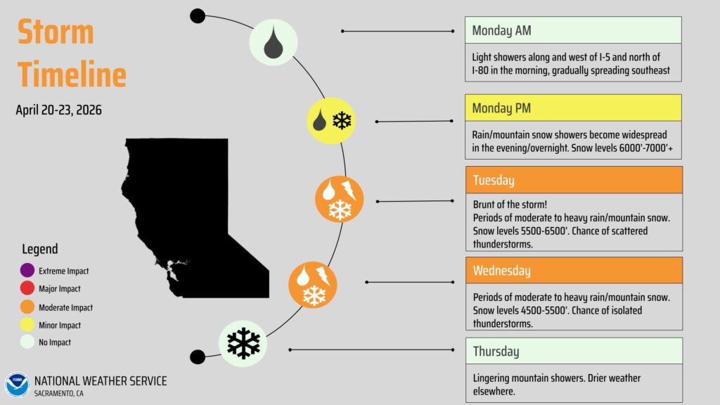
A winter storm watch has been issued for the Lake Tahoe area and Lassen Volcanic National Park, with the National Weather Service warning of significant snow expected Tuesday through Wednesday.
The watch covers higher elevations across multiple NorCal counties, including Tehama, Butte, Plumas, Sierra, Nevada, and Placer counties above 3,000 feet. Snowfall amounts could be significant depending on where the system tracks, and travel conditions on mountain highways are expected to deteriorate.
For anyone planning a trip to the mountains this week, now is the time to check road conditions before heading out. Highway 89, the roads around Lassen, and the passes connecting the Central Valley to the Tahoe Basin are all likely to be affected. Chains or snow tires may be required.
The timing is a bit unusual given how late in April we are, but late-season storms are not unheard of in NorCal’s mountain ranges. The Sierra Nevada and Cascades have surprised drivers and hikers well into May in previous years, and conditions above 5,000 feet can deteriorate faster than forecasts suggest.
Recreationists with backcountry plans this week should monitor updated NWS forecasts closely. Avalanche conditions can increase significantly following late-season storms, particularly on slopes that have already started to consolidate and warm with spring sunshine. Caltrans and NHP will have updated road information as the storm approaches. Check before you drive.