California Snowpack Shows Significant Improvement in Third Snow Survey of the Year
With a blizzard on the horizon in the Sierra, water officials in California needed to conduct their annual snowpack survey a day early to avoid the dangerous conditions. What they found was a significantly improved snowpack just before the storm of the year, which could drop 10 feet of additional snow on the region.
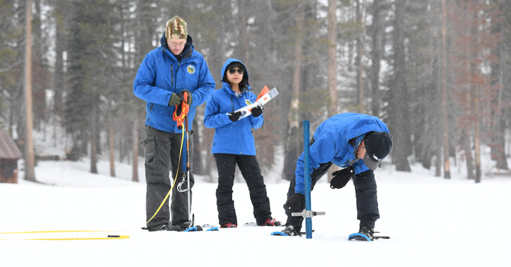
The Department of Water Resources (DWR) conducted its third snow survey of the season on Thursday, revealing that the snowpack is making strides but remains below the yearly average. At Phillips Station, surveyors found 47.5 inches of snow depth and an 18-inch snow water equivalent, marking 77 percent of the average for this spot. The snow water equivalent, crucial for California’s water supply forecasts, indicates the volume of water held within the snowpack.
Statewide, the snowpack has improved from a mere 28 percent of average at the year’s start to 80 percent of the average as of the latest survey, showcasing significant recovery. However, it sits at only 70 percent of the crucial April 1 average, typically the snowpack’s peak. An upcoming storm promises to add several feet of snow to the Sierra Nevada, potentially boosting these numbers.
Today’s results reflect continued improvement in the snowpack since the slow and dry start to the water year. An incoming storm is expected to bring several feet of snow to the Sierra Nevada this weekend. Be safe and check the hazardous road conditions at @CaltransDist3 pic.twitter.com/xzXAMLZCbU
— CA – DWR (@CA_DWR) February 29, 2024
“We are now in the last month of the traditional snow season and while conditions have dramatically improved since the beginning of the year, March will be critical in determining if we finish above or below average,” said DWR Director Karla Nemeth. “No matter how the season ends, we are ready to take advantage of the water we do have to benefit communities, agriculture, and the environment, and continue storing stormwater in our groundwater basins for future use.”
January and February storms have brought flooding to parts of the state but were warmer than usual, resulting in more rain than snow in Southern California. This has left the statewide precipitation at 103 percent of average, surpassing snowpack levels. Reservoir storage is above average, thanks to water capture and storage efforts, yet snow runoff is projected to be below average due to the dry early winter.
“California has seen several extreme climate events so far this water year, including record rainfall in Southern California,” said Dr. Michael Anderson, State Climatologist with DWR. “While this pushed statewide precipitation above average, the snowpack still has not caught up from the dry conditions earlier this winter and local conditions still vary significantly from region to region. The upcoming storm will deliver more snow, but the critical month of March will have to deliver enough snowpack to make up for the dry fall and slow start to the year.”
The Sierra snowpack, referred to as California’s “frozen reservoir,” supplies about 30 percent of the state’s water needs. The snow surveys and forecasts play a key role in managing California’s water resources, with the next survey scheduled for April 2, potentially wrapping up this season’s assessments.