Wet Weather Returns to Northern California as Winter Storms Line Up

After weeks of mostly dry and mild conditions, Northern California is finally seeing winter make a comeback.
Meteorologists say a shift in the jet stream is opening the door for a more active weather pattern, bringing rounds of rain to lower elevations and much-needed snow to the mountains. The change comes after a prolonged stretch of high pressure kept storms focused farther north, leaving much of California warmer and drier than normal to start the year.
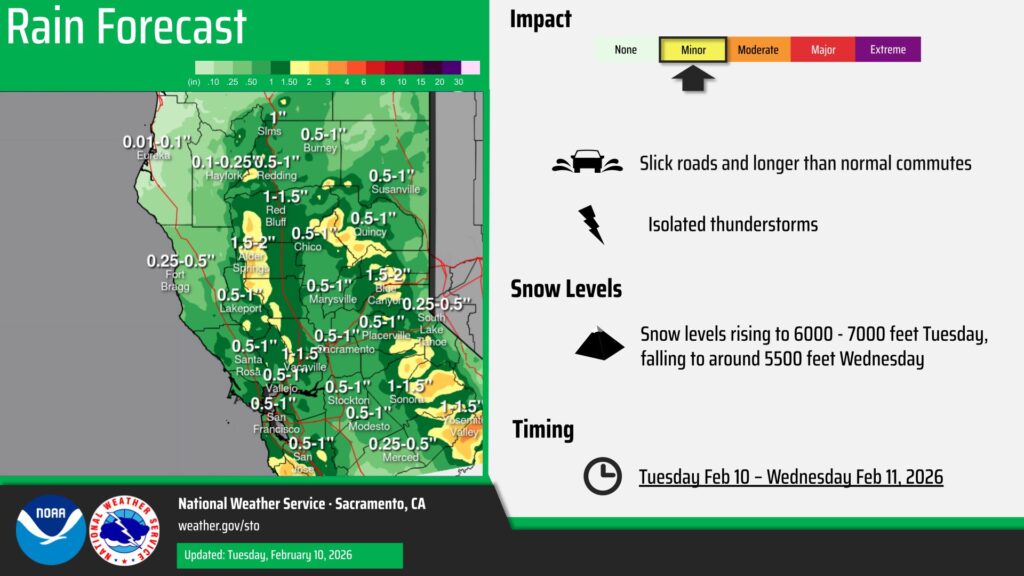
Cities across the region, including Redding and San Francisco, have been running several degrees above average with rainfall totals lagging well behind typical winter levels. That trend is expected to reverse as colder air and Pacific storms move inland through mid-February.
The biggest impact will be felt in the Sierra Nevada, where snow levels are forecast to drop quickly early this week. Travelers heading over Donner Pass along Interstate 80 could encounter slick roads, reduced visibility, and accumulating snow, especially Tuesday into Tuesday night.
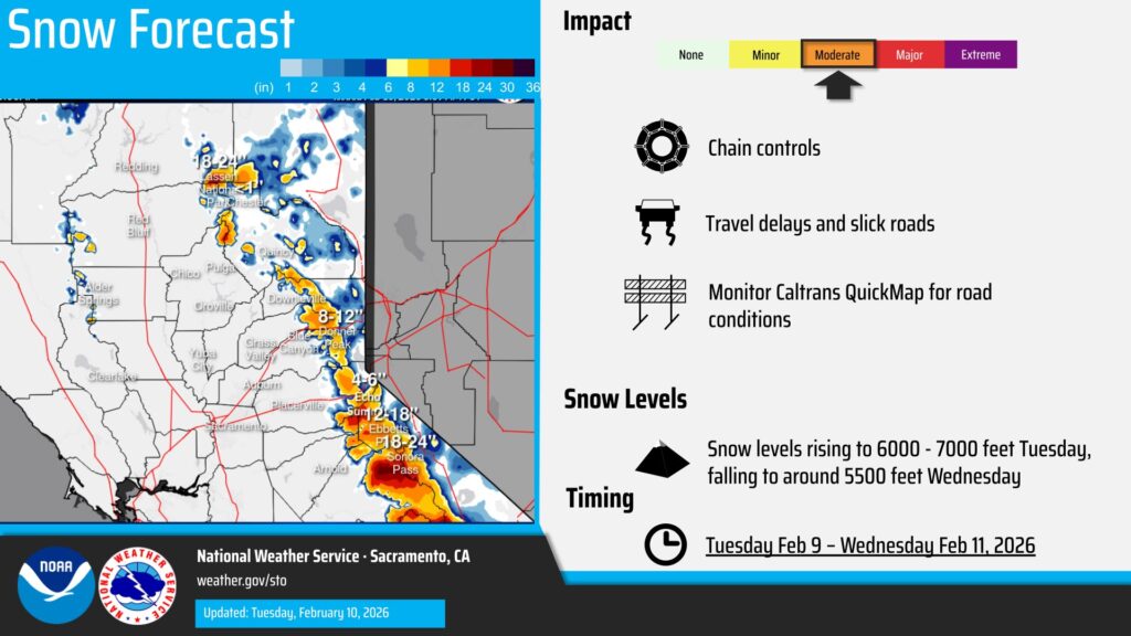
Forecasters are also warning of gusty winds that could create difficult travel for high-profile vehicles and contribute to blowing snow in exposed areas.
While conditions may briefly calm later in the week, additional storm systems are lining up for Northern California by the weekend and into late February. With snowpack and reservoirs still running below average, even modest storms are a welcome boost as the heart of winter presses on.