Atmospheric River Storms Bring Flood Risk Across Northern California

Northern California is heading into a wet stretch as multiple storm systems funnel atmospheric river moisture into the region over the next week.
The National Weather Service offices in Sacramento and Reno have issued Flood Watches covering the Valley, Foothills, and Sierra from Saturday afternoon through Friday, Dec. 26. While flooding is not expected every day, periods of heavy rain could create localized issues.
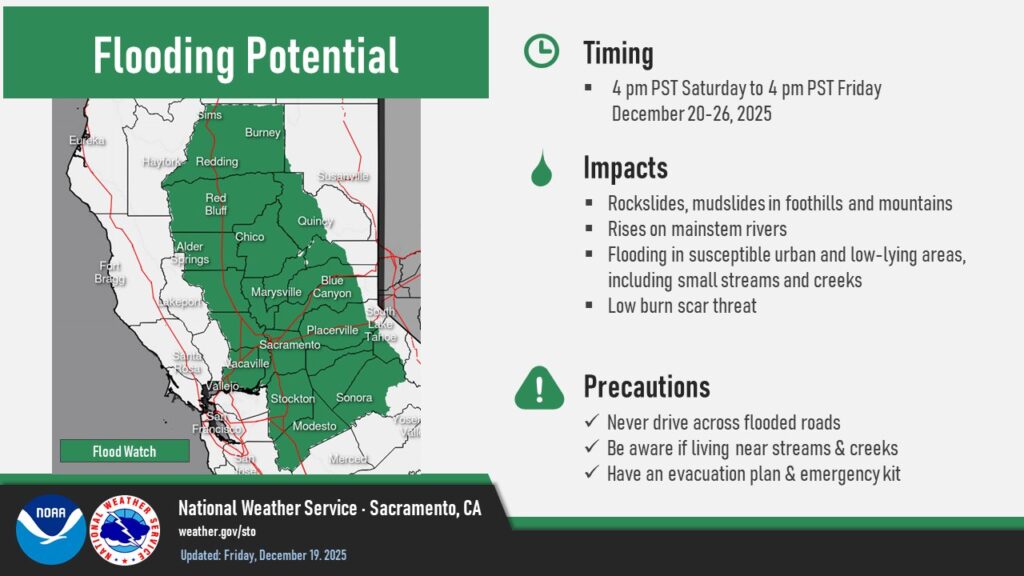
The most likely concern is street and urban flooding, which could begin as early as Sunday. Poorly drained intersections, roads, and grassy areas may see standing water at times. Drivers are urged to avoid flooded roads, as even shallow water can make conditions unsafe.
Creek and stream flooding is less likely early in the event thanks to relatively dry conditions leading into the storms. Valley creeks should have capacity to handle runoff through at least Monday, though fast-moving water is expected in foothill streams that are usually dry. After a brief lull Tuesday, the risk for minor creek flooding increases again from Tuesday night through Thursday, especially near waterways that have flooded in the past.
Major rivers regulated by dams are not expected to flood. Reservoirs like Folsom Lake, Lake Oroville, and Shasta Lake have ample storage, allowing managers to control releases as needed.