Brand New 300-Mile Lost Sierra Trail Will Connect 15 Communities from Tahoe to Lassen
The Sierra Nevada mountain range is the gem of Northern California, running 400 miles from Yosemite all the way up to Lassen. The mountains created wealth for people during the Gold Rush of the 1800’s, and today continues to provide wealth in the form of outdoor opportunities and water supply. The Sierra are the true heart of California.
While much of the mountain range is a popular destination for visitors, there are lesser known areas that bring their own beauty, charm and adventure to anyone that visits. This brand-new 300 mile trail is attempting to connect these communities to create one of the great outdoor resources seen on the west coast.
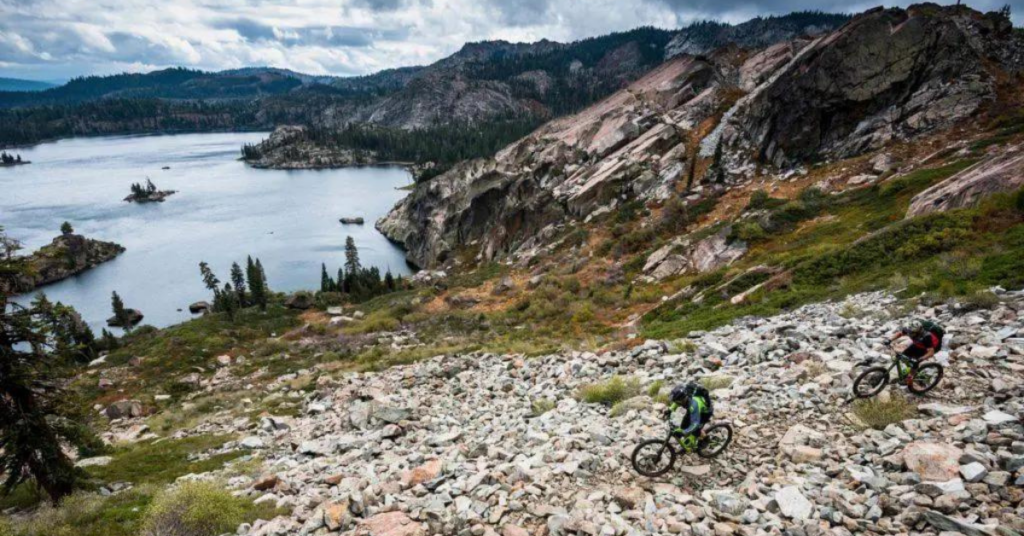
The Lost Sierra Trail will connect 15 communities in the lesser known region of the Sierra from Tahoe to Lassen, as well as pay homage to the historic Gold Rush-era mail delivery route. This new trans-Sierra Nevada and Cascade Range route allows for all dirt trail travelers to enjoy the area including hikers, mountain bikers, moto riders, equestrians, trail runners, hunters, fishermen, wildlife, grandmothers and babies in backpacks. The trail is currently in development from the Sierra Buttes Trail Stewardship, which is working under a grant from the Sierra Nevada Conservancy.
Included in the trail system is Truckee, Loyalton, Sierraville, Sierra City, Downieville, Quincy, Graeagle, Portola, Taylorsville, Greenville, Jonesville, Chester, Westwood, Susanville and Reno.

Unliked the famed trails of California, including the Pacific Crest Trail and John Muir Trail, The Lost Sierra Trail will differentiate itself by allowing travelers of all kinds.
“The Lost Sierra Route is different in that it’s a ‘Trail for Everyone,’ from equestrians and hikers to cyclists and dirt bikers,” according to a statement released by SBTS. “Also, unlike the [Pacific Crest Trail] or [John Muir Trail], the Lost Sierra Route will find its way onto ‘Main Street’ in every town, bringing trail users into the heart of the town for accommodations and resupply opportunities, helping fuel a much-needed economic engine.”
Part of the Lost Sierra Trail plan is to create a passport, incentivizing travelers to stop in the different communities and receive stamps. This will encourage visitors to the 15 different communities on the trail, an economic boost through outdoor tourism.
“The Trails Master Plan will not only create a way for trail travelers to see these small towns, but it will also have a massive positive impact on the local economy. Small restaurants, gas stations, and local shops will have the ability to serve people from other places, creating connections as well as much-needed jobs and revenue for their business and town,” said the SBTS.
To date, project funding has been provided by Sierra Nevada Conservancy, California Off-Highway Vehicle Division grants, California State Parks & Recreation grants, California State proposition funds, National Forest Foundation grants, Secure Rural Schools, Outdoor Industry partners, Adopt a Trail sponsors and SBTS matching funds. There is no current timetable for the construction or completion of the project.
Here’s a video that goes into full detail on the project: