Forecasters Warn Christmas Storm Could Rapidly Intensify Into ‘Bomb Cyclone’
Northern California’s Christmas storm could intensify into a bomb cyclone, raising concerns about damaging winds, flooding, and widespread travel disruptions just as holiday plans peak.
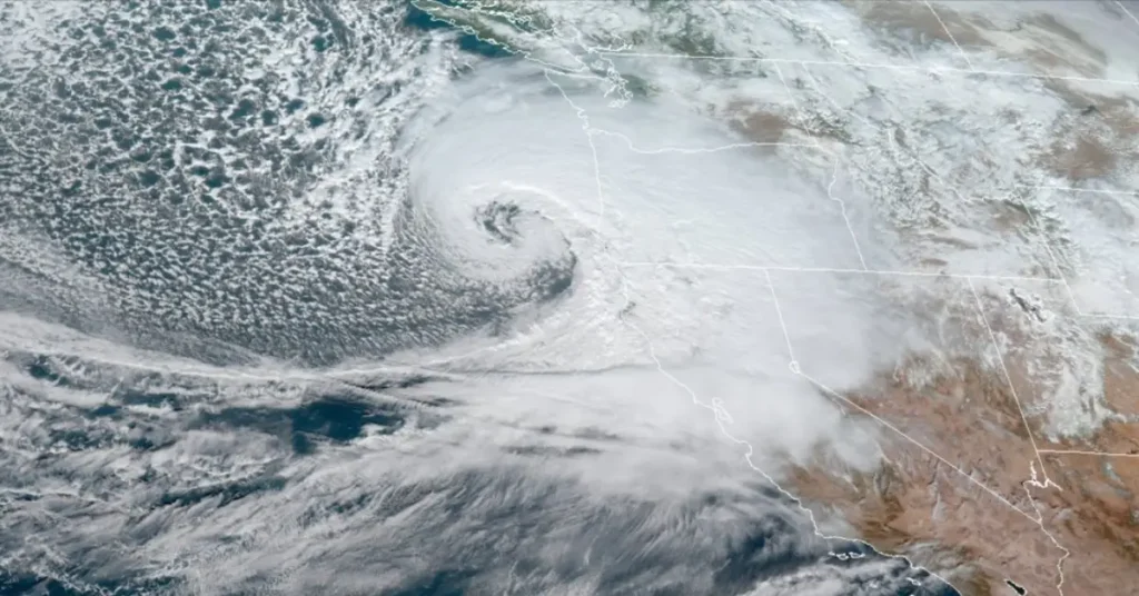
Forecasters say the powerful system expected to approach the coast Tuesday could meet the meteorological criteria for bombogenesis—a rapid strengthening that occurs when a storm’s central pressure drops sharply in a short period of time. At the latitude of San Francisco, that threshold is a pressure drop of 17 millibars in 24 hours. Some models now project a drop closer to 20 millibars, which would firmly qualify the storm as a bomb cyclone.
According to the National Weather Service, the setup is unusual for California. A rare clash between dry sub-Arctic air and warm, moisture-rich subtropical air over the Pacific is expected to fuel rapid storm intensification as the system moves nearly parallel to the coast.
Meteorologists warn that the strongest impacts could arrive Tuesday night into early Wednesday. Wind gusts may exceed 55 mph along the coast and 45 mph inland, with higher gusts possible in exposed coastal and mountain areas. The storm’s south-southeast wind direction is especially concerning, as many trees are less adapted to withstand winds from that angle.
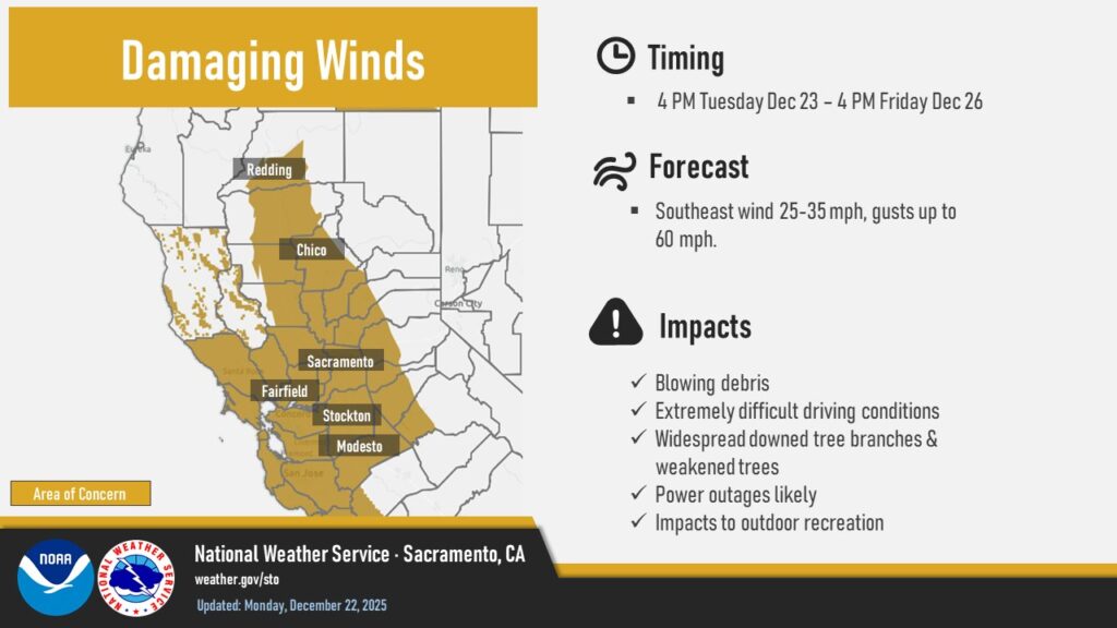
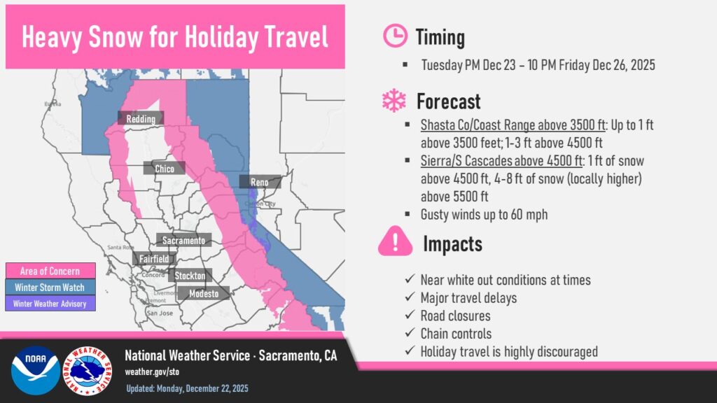
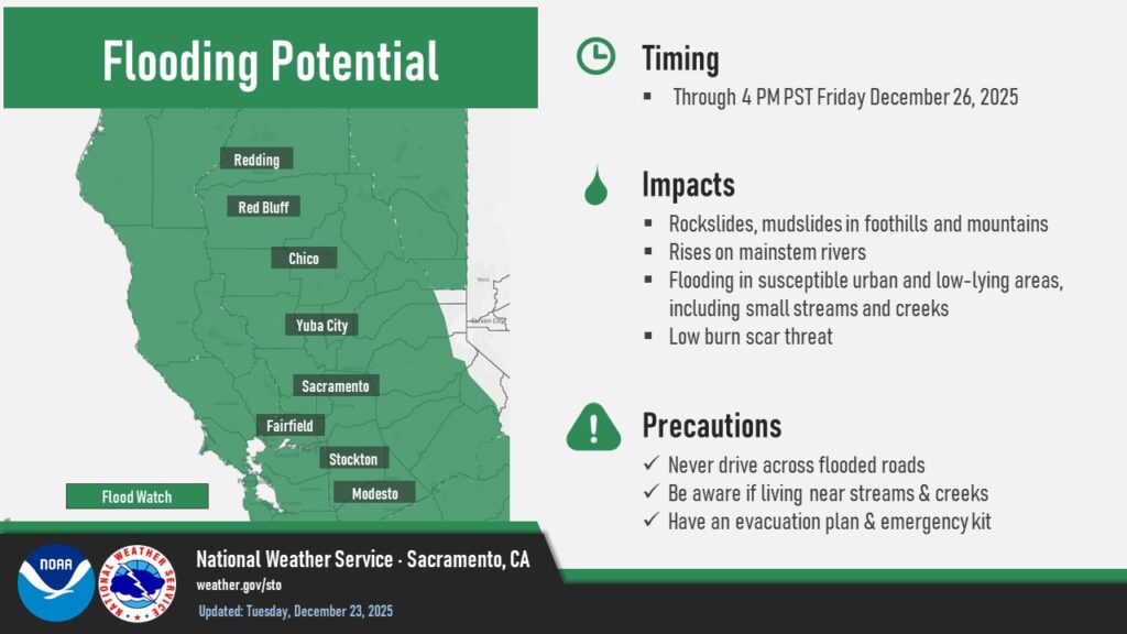
Heavy rain ahead of the storm has already saturated soils, increasing the risk of downed trees, power outages, and urban flooding. Forecasters say nighttime flooding could be particularly dangerous due to poor visibility.
Whether officially classified as a bomb cyclone or not, officials say the storm has the potential to be one of the most impactful systems Northern California sees this holiday season.