Incoming ‘Bomb Cyclone’ Storm to Bring Heavy Rain and Strong Winds to Northern California
California is bracing for its first major storm of the season as a powerful bomb cyclone approaches, set to bring as much as 8 inches of rain to parts of the state this week. Starting Tuesday afternoon, the storm will unleash heavy rain and gusty winds, making for a soggy and windy few days across the region.
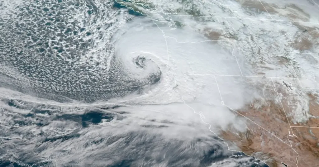
A bomb cyclone forms when cold and warm air collide over the ocean, causing atmospheric pressure to drop rapidly. This system is forecast to develop over the Pacific on Monday evening, with pressure expected to plummet by at least 50 millibars in 24 hours—well above the threshold for a bomb cyclone.
A massive "bomb cyclone" is set to explode off the U.S. West Coast with hurricane force winds, flooding rains, and enormous mountain snow from Category 5 atmospheric river.
— Ryan Maue (@RyanMaue) November 18, 2024
Central pressure will fall almost 70 mb / 24 hours reaching 942 mb — similar to Category 4 hurricane. pic.twitter.com/lZEKOr9fNb
The storm will first hit the North Coast, where coastal ranges could see up to 8 inches of rain through Thursday, while lower elevations expect 2 to 4 inches. Rain will spread south by Wednesday morning, bringing 1 to 2 inches to San Francisco and 0.5 to 1 inch to other parts of the Bay Area. A second wave of rain Friday through Saturday could add another 2 to 3 inches in the North Bay.
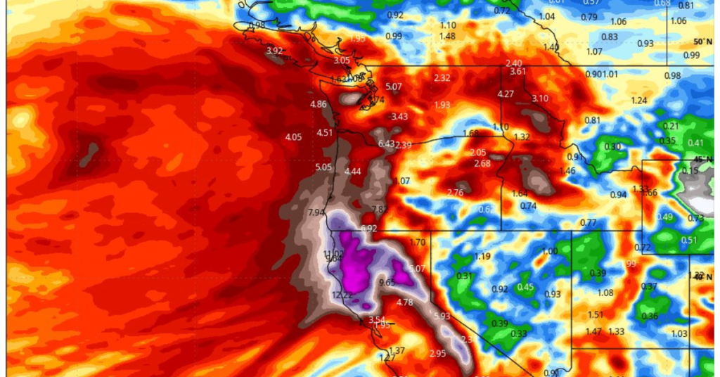
Although rivers aren’t expected to flood due to the dry autumn, some nuisance flooding on roads is possible. Strong winds, with gusts up to 40 mph along ridges and the coast, will add to the storm’s impact.
The storm door is officially open—early hints of winter have arrived.