NASA Captures the Seasons Changing Over Lake Tahoe in Stunning Satellite Images
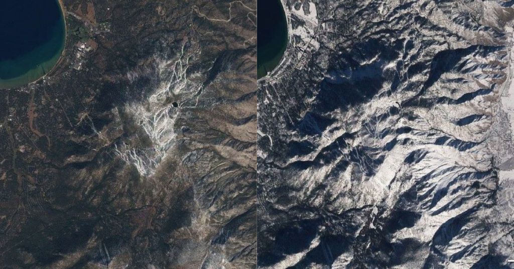
While Lake Tahoe is famous for its crystal-clear blue water and snowy peaks, NASA has shown that the region’s seasonal transformation is even more dramatic from space. Using the Advanced Land Imager aboard the Earth Observing-1 satellite, NASA captured a year of change around Tahoe from August 2009 to March 2010, revealing how snow, sunlight, vegetation, and even lake color shift through the seasons.
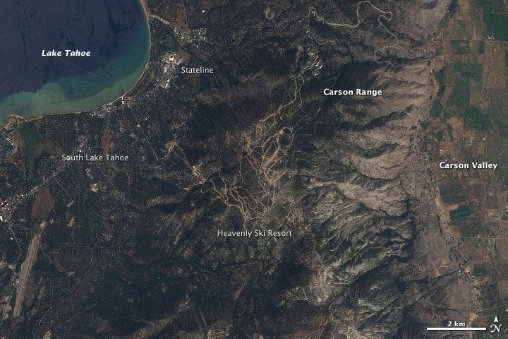
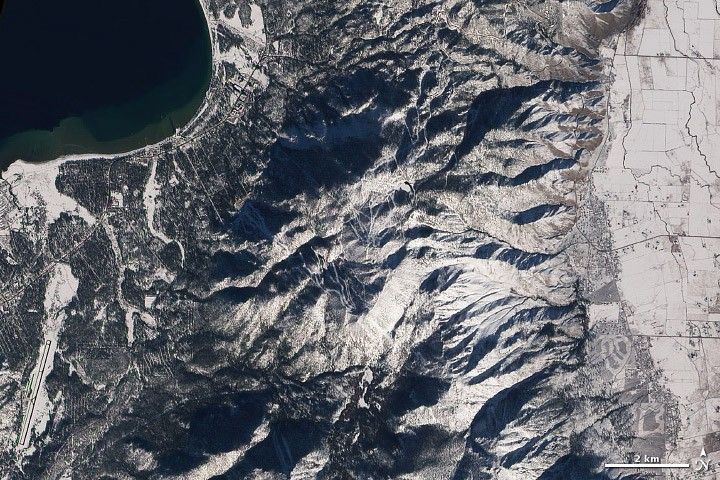
One of the clearest signals is snow. The Heavenly Ski Resort, visible from space in these images, is among the first areas to turn white each fall and among the last to melt by June. In 2009, roughly 37 percent of Tahoe’s precipitation fell as snow, fueling a ski season that typically stretches from November through April.
Here are the images of the seasons changing from August to March:
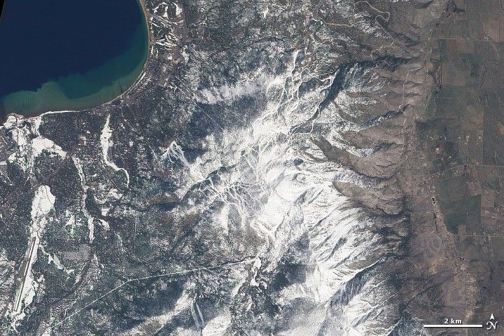
Spring brings its own spectacular changes. As rains and melting snow swell the 63 streams that feed the lake, dark plumes of sediment spill into Tahoe’s famously clear waters, especially near the Upper Truckee River. For a brief window each year, this sediment clouds the lakebed that is typically visible from shore.
Even though Tahoe is ringed by snow, the lake itself resists freezing thanks to its incredible depth of 1,645 feet. Winter surface temperatures hover around 40 to 50 degrees Fahrenheit, warming to around 65 to 70 degrees in summer.
NASA’s images also reveal how sunlight reshapes the landscape. As Earth tilts away from the sun in fall and winter, long shadows spill across the Sierra Nevada. In summer, mountaintops and valleys glow under direct light. These shifts signal the growing season in nearby Carson Valley, where fields turn green, then golden, then white with winter snow.