Storms Forecast to Return to Northern California, Ending Weeks-Long Dry Spell

After nearly three weeks of dry, stagnant weather, Northern California is poised for a notable pattern shift. Forecasters say rain and mountain snow are likely to return between December 17 and 21, potentially ushering in the wettest stretch of weather the region has seen in weeks.
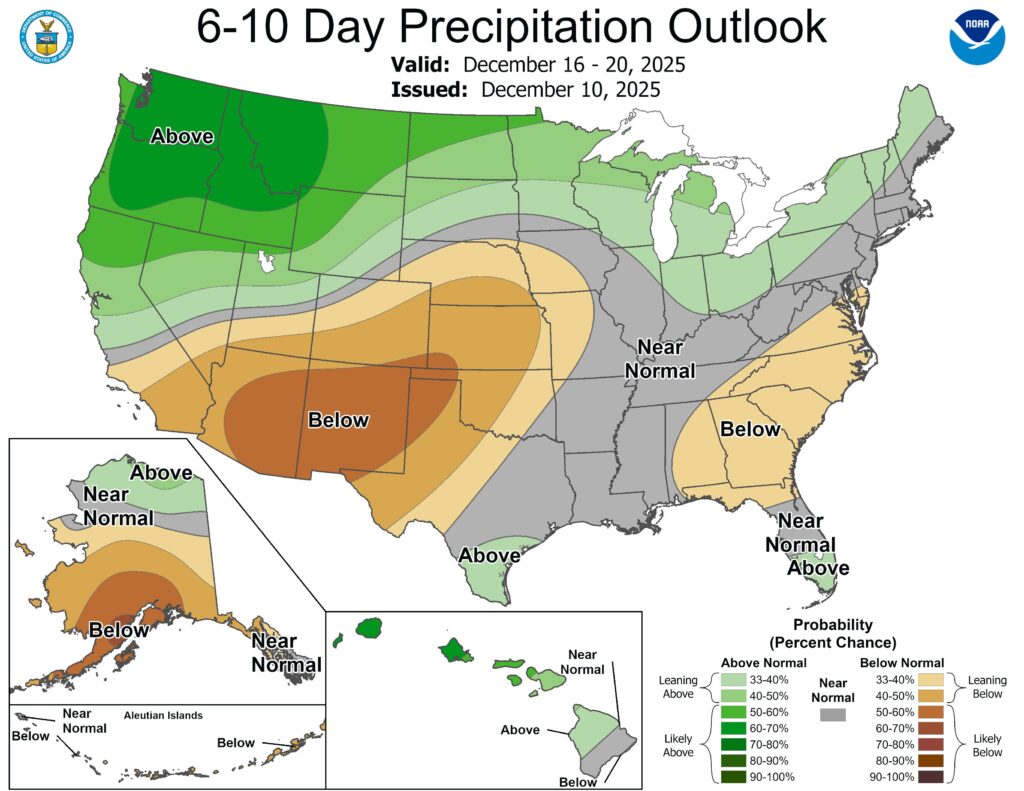
According to the National Weather Service Climate Prediction Center, there’s a 60–70% chance of above-normal precipitation across much of Northern California during that window, with even higher odds farther north. The Bay Area, North Coast, and interior mountains all stand to benefit as the storm track finally dips south.
The first system could arrive as early as Tuesday, Dec. 17, when an atmospheric river currently soaking the Pacific Northwest slides toward California. While the initial storm may be modest in lower elevations, mountain regions like the Klamath Range, Trinity Alps, and northern Sierra Nevada could see more than 2 inches of precipitation, mostly as rain at first due to relatively warm temperatures.
More importantly, that storm may open the door to a series of colder, windier systems later in the week. Those follow-up storms are expected to break the persistent temperature inversions and finally scour out the tule fog that has blanketed much of the Central Valley.
Looking toward the days before Christmas, forecasters say the risk of stronger storms increases between Dec. 19 and 22, bringing the potential for heavier rain, gusty winds, and improving snow conditions in the Sierra. Tahoe could see its snowiest stretch of the season so far just before the holidays.
While exact totals remain uncertain, confidence is growing that Northern California’s quiet weather pattern is about to end — and end decisively.