Tahoe Forecast to Receive Up to 4 Feet of Snow by Christmas

Winter is finally starting to show up in the Tahoe region—but not all at once.
According to forecasters, the next stretch of weather will bring several days of rain to the Sierra before colder temperatures arrive. That means the weekend and early part of next week will likely feel wet and messy rather than snowy, especially at lower elevations.
The good news comes a few days later. Around Dec. 22, colder air is expected to move in, allowing rain to switch over to snow around Lake Tahoe and higher elevations. Once that happens, snow could start piling up quickly.
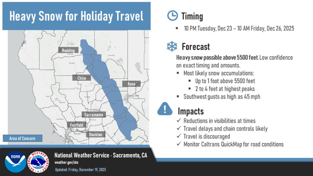
Forecast models are lining up around a solid stretch of snow through Christmas. While it’s still too early to pin down exact totals, two to four feet of snow by Christmas Day is a realistic possibility. Even the lower end of that range would be a big improvement after a slow start to the winter snow season.
If the forecast holds, the timing could be just right for those hoping for a white Christmas in the Sierra. Snow levels should stay low enough to benefit ski resorts and mountain communities, with conditions improving as the week goes on.
After Christmas, forecasters are watching a potential break in the storm pattern, but there are signs that more snow could follow soon after. More details—and more confidence in snowfall totals—should come as the storm window gets closer.