A Series of Storms Heading for Northern California Will Bring Snow and Rain Until Next Week
After a dry start to December, Northern California is bracing for a series of storms set to bring much-needed rain, Sierra snow, and gusty winds through the weekend and into early next week.
A high-pressure system that kept the region dry in recent weeks is breaking down, allowing storms to move in. The first system is expected to arrive late Wednesday, followed by another stronger system this weekend. Additional precipitation could extend into early next week.
A quick-moving weather system will move through Wednesday afternoon through Thursday, bringing showers and mountain snow showers to interior NorCal. Here is a look at potential timing! #CAwx
— NWS Sacramento (@NWSSacramento) December 11, 2024
Forecast: https://t.co/7FMe5twj20
Roads: https://t.co/6jnhwJwK5a pic.twitter.com/rDe0pRehNx
Rainfall totals will vary, with the Sacramento Valley likely receiving up to 2 inches of rain by Sunday and foothill areas north of I-80 expecting up to 3 inches. Coastal and mountain areas may see even higher amounts.
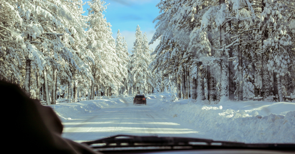
The Sierra Nevada will see significant snowfall, with elevations above 5,000 feet expected to accumulate 8-16 inches of snow by Sunday. Mountain peaks could receive up to 2 feet of snow, making for hazardous travel conditions. Chain controls, delays, and potential road closures are likely over mountain passes.
??A Winter Weather Advisory has been issued for elevations above 5000' along the Sierra/southern Cascades from 10 pm Wed – 4 pm Thu. This quick moving system will bring mountain travel impacts late Wednesday into Thursday
— NWS Sacramento (@NWSSacramento) December 10, 2024
?Additional snow expected through the weekend#CAwx pic.twitter.com/ZU1MXG2tZv
Gusty winds will accompany the storms, with speeds reaching 30 MPH in the valley and up to 40 MPH in the Sierra.
Looking ahead, another quick-moving storm may arrive on Monday, bringing additional rain and snow before the region dries out midweek.
Travelers are urged to prepare for winter conditions, especially in the Sierra, and stay updated on road and weather conditions. These storms will provide a much-needed boost to the snowpack and water supply as the state heads into the winter season.