Satellite Images Show Sierra Snowpack Transformation After Historic May Snowfall
In a surprising twist to the spring season, California’s Sierra Nevada presented a winter-like spectacle in early May 2024. On May 5, the Donner Pass weather station recorded a significant 26.4 inches (67 centimeters) of snowfall, marking it the snowiest day of the 2023-2024 season.
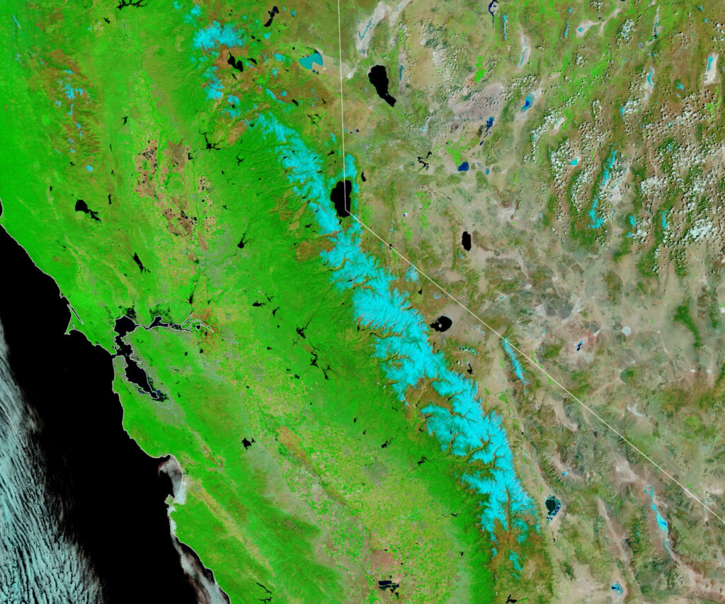
The aftermath of this unusual spring snowstorm was captured beautifully by the MODIS (Moderate Resolution Imaging Spectroradiometer) on NASA’s Terra satellite. Images taken at 11 a.m. local time on May 5 show the Sierra blanketed in snow, contrasting sharply with images from May 3 before the storm hit. These satellite images utilize false-color (bands 7-2-1) to distinguish snow (depicted in blue) from clouds (white), providing a clear visual representation of the snow coverage.
Here is the May 3 image:
And here is the May 5 image:
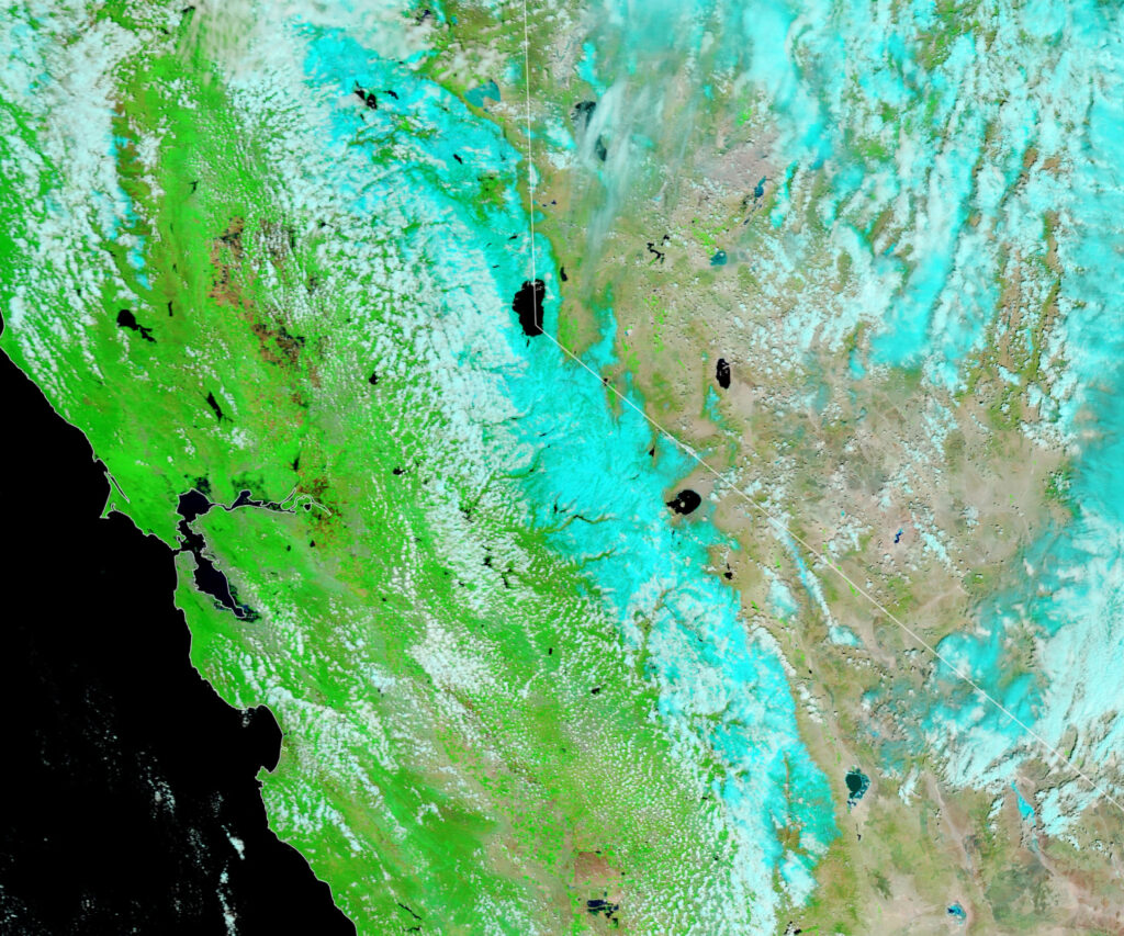
The Sierra Nevada is known for its fluctuating snowpack levels, which have been remarkably close to average in 2024 after years of extreme variances. Prior to this May storm, the snowfall at Donner Pass was just an inch shy of the 30-year average (360 inches). The recent snowfall pushed the total to 108 percent of the average at this location.
This season’s late snowfalls have been critical in replenishing the snowpack across the Sierra range, particularly following an atmospheric river event between February 28 and March 3, which brought substantial snow to the region. According to the California Department of Water Resources, the snow water equivalent after the May snowfall was above average in the Northern Sierra, close to average in the central part, and slightly below average in the southern areas.