This Rare Weather Pattern Is Flipping California’s Winter Upside Down
A rare weather pattern is flipping California’s typical winter temperature script, leaving valley communities colder and gloomier than the mountains above them.
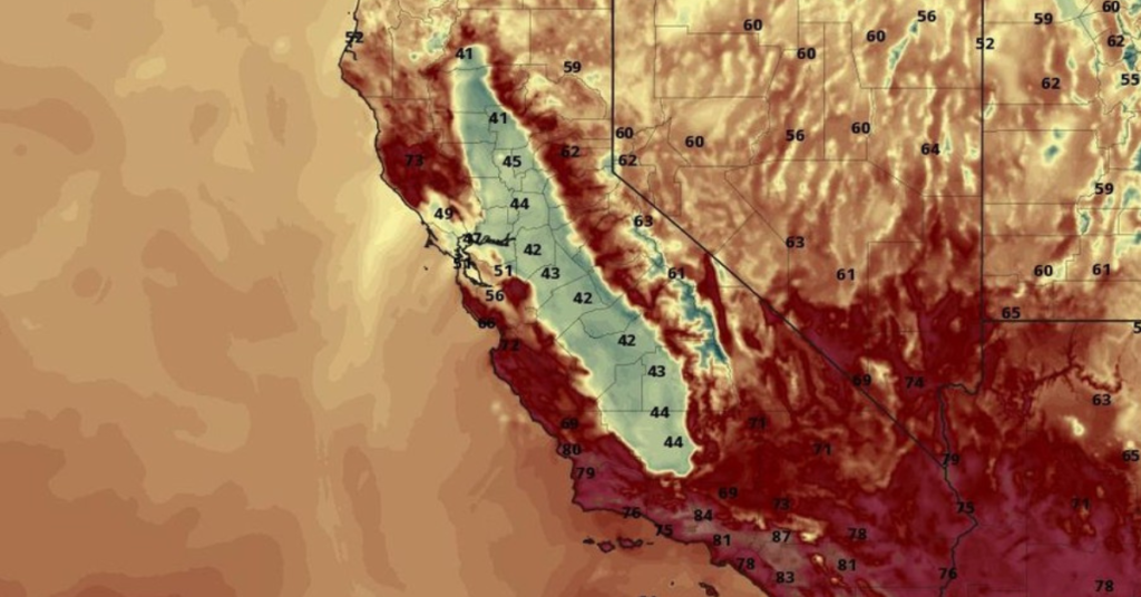
New NASA satellite images show a massive blanket of tule fog parked over the Central Valley, the result of a strong temperature inversion that has lingered for weeks. During an inversion, cold, moist air becomes trapped near the ground while warmer air sits above it, effectively sealing fog and chilly conditions into low-lying areas like a lid on a pot.
Tule fog is common in late fall and winter, but this episode has been unusually persistent. The fog first formed in November and has remained into December, spreading through the Central Valley and even spilling west through the Carquinez Strait into the Bay Area.
As a result, valley residents are stuck with gray skies and colder-than-normal temperatures, while higher elevations in the foothills and Sierra are seeing clearer skies and noticeably warmer conditions.
So far this month, the Central Valley has averaged lows around 37 degrees and highs near 63, while areas above the fog layer have often felt milder during the day. The Bay Area has also cooled as the fog creeps toward the coast.
Meteorologists say the setup was triggered after a major late-October storm and has been reinforced by calm winds and moist air. Climate scientists note that warmer ocean temperatures and a lack of Sierra snowpack are helping maintain the inversion, preventing sunlight from breaking through and lifting the fog.
The National Weather Service has issued multiple dense fog advisories, warning of dangerous driving conditions with visibility dropping below a quarter mile. While tule fog typically lasts about a week, experts say this multi-week event is on the extreme side—and a reminder that winter in California doesn’t always mean colder mountains and warmer valleys.